
In south-central Utah lies an area of corrugated sandstone that looks like someone took a giant backhoe and scooped out a huge chunk, leaving the rest to the vagaries of erosion. It’s called the Box Death Hollow Wilderness, and given its ruggedness and difficult access, it’s probably one of the least visited wilderness areas in the western US. Its name is a combination of the two main canyons; the box, a narrow canyon of Pine Creek, and Death Hollow named for the many cattle that have died trying to cross the rugged canyon.
I first discovered this area when I was perusing my DeLorme atlas for Utah, exploring areas to camp. I love the colorful sandstone country between Escalante and Boulder and discovered a back road that circled a big chunk of wilderness with an enchanting name, that had both campgrounds and dispersed camping. The road was known as Hell’s Backbone, making the area even more enticing. So, I decided to check it out on one of my many trips between Carson City and Tucson.

I arrived in early August 2012 and headed north from Escalante. Huge thunderheads hovered over my path, and a downpour started as soon as I left town. I proceeded up the dirt road, which rapidly turned into a stream. Waterfalls cascaded off the wall of sandstone to the east. Less than 10 miles up the road, I was met with a torrent of water rushing across the road – a flash flood – ending my attempt to check out Hell’s Backbone. I ended up spending a soggy night at Calf Creek campground, where the bats put on quite a show.
This past September I had a few days to go exploring, so I decided to make another try at Hell’s Backbone. I followed the same dirt road north from Escalante and this time I got all the way to the top before the clouds let loose, just as I pulled into the Blue Spruce campground. Blue Spruce are one of my favorite trees and I was pleasantly surprised to find a small population of them in the canyon. This is one of the westernmost populations not counting those planted in yards all over the west. The storm broke just long enough for me to cook up dinner, then the rain returned. Between the wet, the load gurgle of Pine Creek, and the roar of the wind in the trees, I opted not to set up the recording gear.
The clouds cleared overnight so I set about exploring the next day. I got my first real views of Box Death Hollow from the rim road (Hell’s Backbone) and started looking for a trail to descend into the wilderness. I finally found one that went into the box along Pine Creek. This beautiful trail followed the creek down into a deep and narrow gorge cut through steep sandstone walls. The box was lined with pines, firs, and cottonwood, plus a variety of shrubs like wild roses, birch, and willow. A two-year study by the Provo High Botany Club found more than 300 species of plants in the canyon! The trail wasn’t much more than a cattle path with numerous stream crossings and scrambles over rocks and tree roots. It was great fun, but as the dog and I descended the trail, I noticed clouds building up again. Not wanting to get stuck in a narrow canyon during a thunderstorm, I reluctantly turned around and headed back to the car, having only seen the top 3 miles of the box.

With some time left in the day, I headed over to Posey Lake, the other campground in the area. There were already several campers in the campground, so I moved on to the grounds of an old CCC camp, which now served as a dispersed camping area. One side of the camping area was a meadow with a tiny stream. And, as a bonus, the view to the east included some of the higher rocky faces of Box Death Hollow. This looked like a great area for recording. I spent the rest of the day scouting for good recording locations and ran across a lot of elk and deer sign. I set up a recorder that night along the edge of a meadow near a game trail. By the time I got back to camp, the elk were already bugling, and, in the distance, I could hear a Northern Pygmy-Owl calling.
I woke up to flashes of lightning in the distance – right over Box Death Hollow. I began to realize that the area creates its own weather, as the sky was clear at my campsite just a few miles to the west. The storm dissipated shortly after dawn, and by the time I finished my breakfast the sky was completely clear.
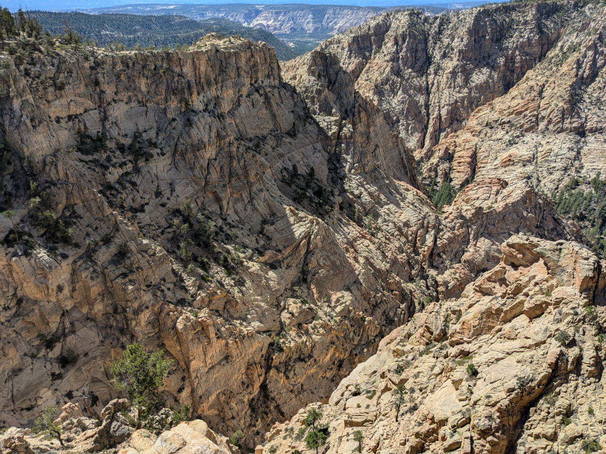
After breakfast, I decided to drive further up Hell’s Backbone, to Box Death Hollow Bridge, which appeared to be the best viewing spot of the hollow. And indeed, it was. The views of the corrugated landscape were spectacular, and I could see why there were so few trails in the canyons. The dog and I spent some time exploring the many footpaths along the overlook, then headed back to our spot at the CCC camp.

Another beautiful night, full of stars, pygmy-owls and elk bugling. After a quiet dawn and breakfast, we packed up and headed in the direction of home, first stopping at a trailhead just north of Escalante for the lower box of Pine Creek (the terminus of the trail I was on earlier). Once again, the clouds were building over the hollow, with distant rumbles of thunder. I lost the trail less than 1 mile in, due to the shifting sands of frequent floods. With the clouds building quickly and many miles to drive that day, I opted not to chase down the trail markers and turned around for the parking area.
I made a short video of my adventures along Hell’s Backbone:
Discover more from Wild Mountain Echoes
Subscribe to get the latest posts sent to your email.